Show Posts Show Posts
|
|
Pages: 1 2 [3] 4
|
|
35
|
Earth Changes / Antarctica & the Arctic / Re: History of Antarctica
|
on: October 07, 2010, 01:29:35 pm
|
|
Voyagers round the Horn frequently met with contrary winds and were driven southward into snowy skies and ice-encumbered seas; but so far as can be ascertained none of them before 1770 reached the Antarctic Circle, or knew it, if they did. The story of the discovery of land in 64° S. by Dirk Gerritz on board the Blijde Boodschap in 1599 was shown to be the result of a mistake[citation needed] of a commentator, Kasper Barlaeus, in 1622. A similar story of sighting "snow-covered mountains" beyond the 64° S in 1603 is told of the Spaniard Gabriel de Castilla[3].
|
|
|
|
|
36
|
Earth Changes / Antarctica & the Arctic / Re: History of Antarctica
|
on: October 07, 2010, 01:29:19 pm
|
|
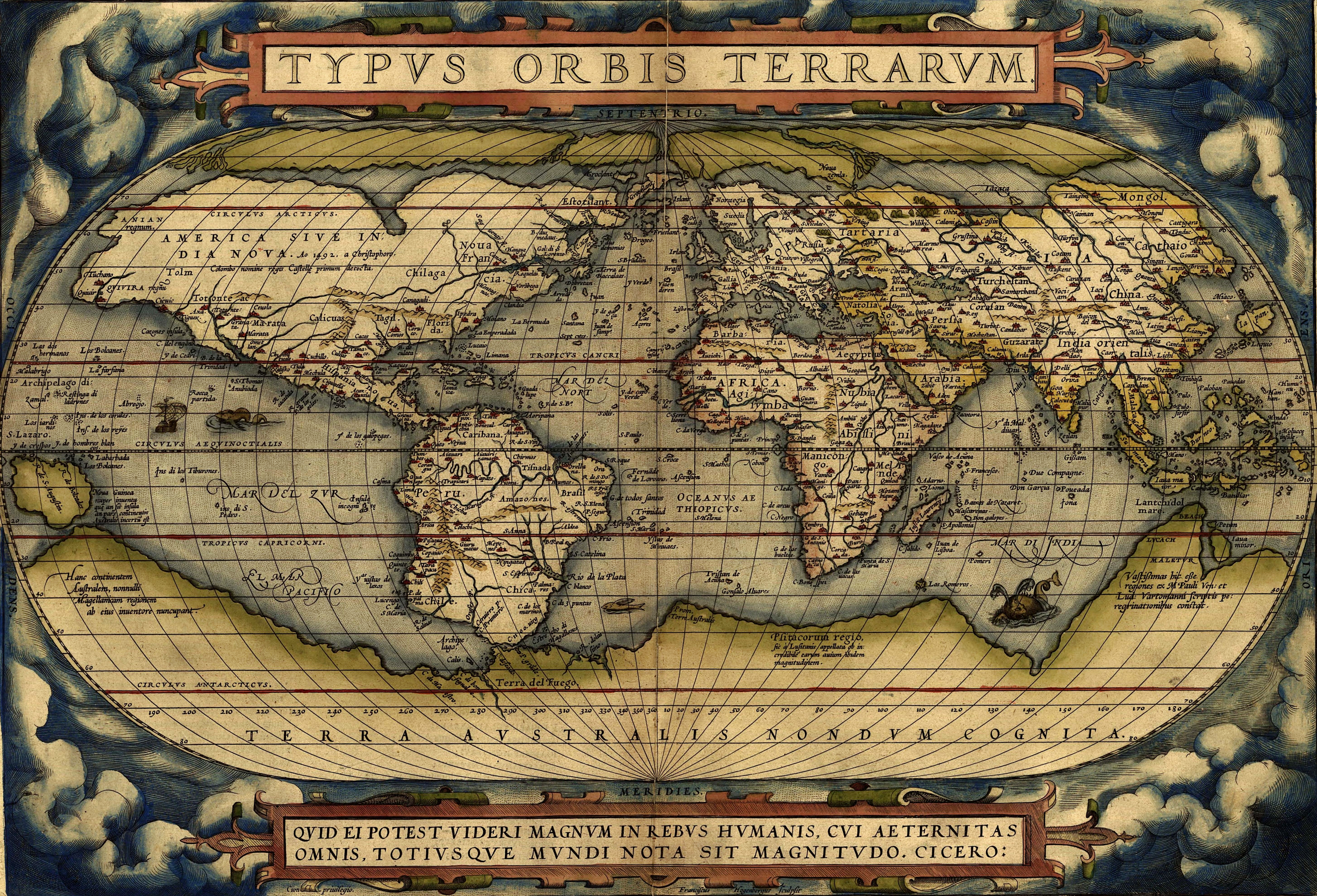
The doubling of the Cape of Good Hope in 1487 by Bartolomeu Dias first brought explorers within touch of the Antarctic cold, and proved that there was an ocean separating Africa from any Antarctic land that might exist. In 1513, the Ottoman Turkish admiral Piri Reis drew a world map that has been said to show part of the Antarctic continent.
Ferdinand Magellan, who passed through the Straits of Magellan in 1520, assumed that the islands of Tierra del Fuego to the south were an extension of this unknown southern land, and it appeared as such on a map by Ortelius: Terra australis recenter inventa sed nondum plene cognita ("Southern land recently discovered but not yet known").[citation needed]
European geographers connected the coast of Tierra del Fuego with the coast of New Guinea on their globes and allowing their imaginations to run riot in the vast unknown spaces of the south Atlantic, south Indian and Pacific oceans. They sketched the outlines of the Terra Australis Incognita ("Unknown Southern Land"), a vast continent stretching in parts into the tropics. The search for this great south land or Third World was a leading motive of explorers in the 16th and the early part of the 17th centuries.
Quirós in 1606 took possession for the king of Spain all of the lands he had discovered in Australia del Espiritu Santo (the New Hebrides) and those he would discover "even to the Pole".
Francis Drake like Spanish explorers before him had speculated that there might be an open channel south of Tierra del Fuego. Indeed, when Schouten and Le Maire discovered the southern extremity of Tierra del Fuego and named it Cape Horn in 1615, they proved that the Tierra del Fuego archipelago was of small extent and not connected to the southern land.
Finally, in 1642 Tasman showed that even New Holland (Australia) was separated by sea from any continuous southern continent.
|
|
|
|
|
37
|
Earth Changes / Antarctica & the Arctic / Re: History of Antarctica
|
on: October 07, 2010, 01:29:04 pm
|
|
The search for Terra Australis Incognita
In the Western world, belief in a Cold Land—a vast continent located in the far south of the globe to "balance" out the northern lands of Europe, Asia and North Africa—had existed for centuries. Aristotle had postulated a symmetry of the earth, which meant that there would be equally habitable lands south of the known world. The Greeks suggested that these two hemispheres, north and south, were divided by a 'belt of fire'[citation needed].
It was not until Prince Henry the Navigator began in 1418 to encourage the penetration of the torrid zone in the effort to reach India by circumnavigating Africa that the exploration of the southern hemisphere began. In 1473 Portuguese navigator Lopes Gonçalves proved that the equator could be crossed, and cartographers and sailors began to assume the existence of another, temperate continent to the south of the known world.
|
|
|
|
|
39
|
Earth Changes / Antarctica & the Arctic / History of Antarctica
|
on: October 07, 2010, 01:27:33 pm
|
|
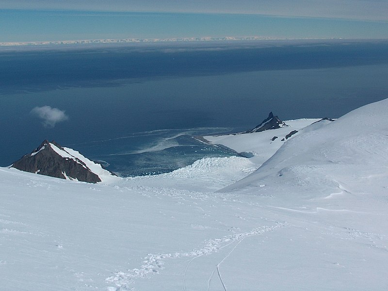
History of Antarctica
The history of Antarctica emerges from early Western theories of a vast continent, known as Terra Australis, believed to exist in the far south of the globe. The term Antarctic, referring to the opposite of the Arctic Circle, was coined by Marinus of Tyre in the second century AD.
The rounding of the Cape of Good Hope and Cape Horn in the 15th and 16th centuries proved that Terra Australis Incognita ("Unknown Southern Land"), if it existed, was a continent in its own right. In 1773 James Cook crossed the Antarctic Circle for the first time but although he discovered nearby islands, he did not catch sight of Antarctica itself.
In 1820, several expeditions claimed to have been the first to have sighted Antarctica, with the very first being the Russian expedition led by Fabian Gottlieb von Bellingshausen and Mikhail Lazarev. The first landing was probably just over a year later when American Captain John Davis, a sealer, set foot on the ice.
The first Norwegian expedition to Antarctica was led by Captain Carl Anton Larsen aboard the barque Jason in 1892. During the expedition he was the first to discover fossils in Antarctica, for which he received the Back Grant from the Royal Geographical Society.[1] In December 1893 he also became the first person to ski in Antarctica where the Larsen Ice Shelf was named after him. Larsen is also considered the founder of the Antarctic whaling industry and the settlement at Grytviken, South Georgia.[2]
Once the North Pole had been reached in 1909, several expeditions attempted to reach the South Pole. Many resulted in injury and death. The Norwegian Roald Amundsen finally reached the Pole in December 1911, following a dramatic race with the Englishman Robert Falcon Scott.
|
|
|
|
|
40
|
Science & Technology / Geology / Re: Geology of Antarctica
|
on: June 14, 2010, 03:11:38 pm
|
 Antarctica without its ice-shield. This map does not consider that sea level would rise because of the melted ice, nor that the landmass would rise by several hundred meters over a few tens of thousands of years after the weight of the ice was no longer depressing the landmass. |
|
|
|
|
42
|
Science & Technology / Geology / Re: Geology of Antarctica
|
on: June 14, 2010, 03:10:29 pm
|
Geology of present-day AntarcticaThe geological study of Antarctica has been greatly hindered by the fact that nearly all of the continent is continuously covered with a thick layer of ice. However, new techniques such as remote sensing have begun to reveal the structures beneath the ice. Geologically, West Antarctica closely resembles the Andes of South America.[1] The Antarctic Peninsula was formed by uplift and metamorphism of sea-bed sediments during the late Paleozoic and the early Mesozoic eras. This sediment uplift was accompanied by igneous intrusions and volcanism. The most common rocks in West Antarctica are andesite and rhyolite volcanics formed during the Jurassic Period. There is also evidence of volcanic activity, even after the ice sheet had formed, in Marie Byrd Land and Alexander Island. The only anomalous area of West Antarctica is the Ellsworth Mountains region, where the stratigraphy is more similar to the eastern part of the continent. The West Antarctic Rift, a major active rift valley, lies between West and East Antarctica. The rift is still active with slow movement of West Antarctica away from East Antarctica. East Antarctica is geologically very old, dating from the Precambrian era, with some rocks formed more than 3 billion years ago. It is composed of a metamorphic and igneous platform which is the basis of the continental shield. On top of this base are various more modern rocks, such as sandstones, limestones, coal and shales laid down during the Devonian and Jurassic periods to form the Transantarctic Mountains. In coastal areas such as Shackleton Range and Victoria Land some faulting has occurred. The main mineral resource known on the continent is coal. It was first recorded near the Beardmore Glacier by Frank Wild on the Nimrod Expedition, and now low-grade coal is known across many parts of the Transantarctic Mountains. The Prince Charles Mountains contain significant deposits of iron ore. The most valuable resources of Antarctica lie offshore, namely the oil and natural gas fields found in the Ross Sea in 1973. Exploitation of all mineral resources by signatory states is banned until 2048 by the Protocol on Environmental Protection to the Antarctic Treaty. http://en.wikipedia.org/wiki/Geology_of_Antarctica
|
|
|
|
|
43
|
Science & Technology / Geology / Re: Geology of Antarctica
|
on: June 14, 2010, 03:09:48 pm
|
|
Mesozoic era (250–65 Ma)
As a result of continued warming, the polar ice caps melted and much of Gondwana became a desert. In East Antarctica the seed fern became established, and large amounts of sandstone and shale were laid down at this time. The Antarctic Peninsula began to form during the Jurassic period (206–146 Ma), and islands gradually rose out of the ocean. Ginkgo trees and cycads were plentiful during this period, as were reptiles such as Lystrosaurus. In West Antarctica conifer forests dominated through the entire Cretaceous period (146–65 Ma), though Southern beech began to take over at the end of this period. Ammonites were common in the seas around Antarctica, and dinosaurs were also present, though only three Antarctic dinosaur genera (in order of naming, Cryolophosaurus, Antarctopelta, and Glacialisaurus) have been described to date. It was during this period that Gondwana began to break up.
|
|
|
|
|
44
|
Science & Technology / Geology / Re: Geology of Antarctica
|
on: June 14, 2010, 03:09:21 pm
|
|
During the Cambrian period, Gondwana had a mild climate. West Antarctica was partially in the northern hemisphere, and during this period large amounts of sandstones, limestones and shales were deposited. East Antarctica was at the equator, where sea-floor invertebrates and trilobites flourished in the tropical seas. By the start of the Devonian period (416 Ma) Gondwana was in more southern latitudes and the climate was cooler, though fossils of land plants are known from this time. Sand and silts were laid down in what is now the Ellsworth, Horlick and Pensacola Mountains. Glaciation began at the end of the Devonian period (360 Ma) as Gondwana became centered around the South Pole and the climate cooled, though flora remained. During the Permian period the plant life became dominated by fern-like plants such as Glossopteris, which grew in swamps. Over time these swamps became deposits of coal in the Transantarctic Mountains. Towards the end of the Permian period continued warming led to a dry, hot climate over much of Gondwana.[1]
|
|
|
|
|